JUSTICE
Joining Urban morphology,
Spatio-Temporal
and socio-cognitive accessibility
for an Inclusive City Environment
The JUSTICE project aims to revisit issues of intra-urban accessibility by linking two research fields that have mostly ignored each other. Social and spatial sciences (including sociology, anthropology, land use planning, and urban studies) have first widely discussed that concrete mobilities (and thus access to the city) can be limited by social, physical, and socio-cognitive inequalities in a context where public spaces, public transportation systems, and buildings are not designed to be fully inclusive. On the other hand, quantitative research in geography has measured and modeled models of accessibility that ignore the aforementioned inequalities, implicitly assuming that accessibility is inclusive.
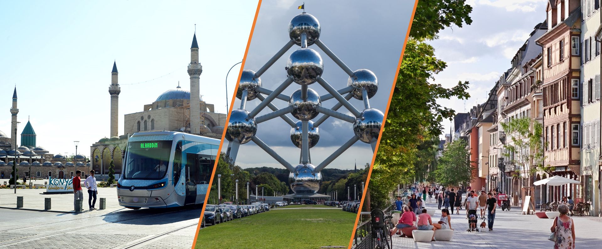
The JUSTICE project will develop on the very idea that accessibility is not the same for everyone, by intersecting and combining qualitative and quantitative approaches. Modelling exercises will thus be multiplied and refined for four specific groups of people who are subject to mobility and urban planning constraints: physically impaired people, blind and visually impaired people, the elderly and socially underpriviledged ones. The way in which social inequalities and disabilities affect accessibility will be addressed by involving the specific audiences at the heart of the research design, as well as policy makers.
The spatio-temporal modelling methods used to measure the accessibility of public transport are in the framework of the project complemented by quantitative and qualitative approaches to highlight physical, financial and socio-cognitive barriers. The aim is to achieve both the construction of a methodological framework that is co-constructed with stakeholders, and recommendations including policy guidelines to help cities to include spatial justice in their inclusiveness strategies.
Organization in workpackages
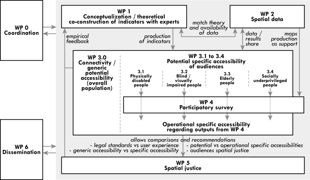
The project is organized in six workpackages (WP), including the project coordination task (WP0).
A first phase of work (WP1) with all the partners will address the confrontation of the state-of-the-art with the experience of representatives of specific audiences and decision-makers, through a series of participative workshops. This co-construction will result in a shared conceptual framework, as well as indicators (e.g. travel time, number of accessible places, etc.) used later in WP3.
Indicators are then selected according to the availability of data in the three cities, defined in WP2. The project actually combines several methods and requires a large and diverse database, which led to the creation of a specific cross-cutting spatial data management task (WP2).
The accessibility calculation task (WP3) combines generic and specific data (transit station elevators, age of passengers…) to provide results. It is decomposed into several tasks, considering the broad and multifaceted definition of accessibility addressed in the JUSTICE project.
Therefore, we measure in WP3.0 both the connectivity and the generic accessibility (i.e. in a classical way, for the general population) through the combination of the modeling approaches.
In WP3.1, the specific accessibility of physically impaired people is measured by only considering the infrastructures and buildings that are accessible to them. WP3.2 to 3.4 measure in the same way the specific accessibility of other specific audiences (blind and visually impaired people, elderly people, socially underprivileged people). All these initial measures, however, only represent a so-called potential accessibility.
In order to assess the accessibility of specific populations more closely, in situ experiments and focus groups are conducted with representatives of the four specific audiences (WP4). This is the best method to collect users’ perceptions and track their specific socio-cognitive barriers, including those related to gender.
These results will enrich the potential accessibility measures and will lead to operational and specific accessibility measures in a second phase of WP3.
These operational and specific accessibility measures are compared to generic accessibility and potential accessibility in WP5. A methodological framework for the recommendations is developed on the basis of the analysis of the results and the round tables with stakeholders. A handbook of good practices will be privileged rather than a ranking of cities. The aim is to highlight the relevant recommendations at the scale of a location or of a network, as well as more general principles to be integrated into urban planning documents. Tangible tools such as digital applications are also developed, in particular to better serve specific populations in public transport. Finally, the partnership built with the main stakeholders ensure, in WP6, a triple dissemination of the approach and the results of the project: oriented towards the general public, oriented towards science and oriented towards the stakeholders.
View the list of project partners involved in the project.
Check out the latest news about the project and the first outcomes.